Fire Health & Safety, Wildfire Articles
Fire Pit Safety Tips
Stay safe around the campfire with tips from the Western Fire Chiefs Association. Learn essential precautions and practices for a worry-free outdoor campfire.
Artificial intelligence (AI) is revolutionizing the way that we can predict wildfires. Explore the technology used to predict wildfires with guidance from the WFCA.
Published:May 30, 2023
Edited:March 1, 2024
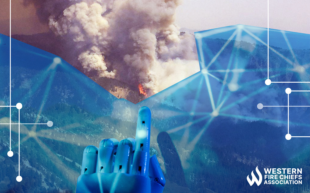
Artificial intelligence (AI) is revolutionizing the way that we can predict wildfires. Explore the technology used to predict wildfires with guidance from the WFCA.
Wildfire detection and monitoring has typically needed a human observer to either scan vast swathes of terrain, or to review live camera footage. This is a significant labor requirement. Additionally, the human eye is limited, especially when looking at different weather or lighting conditions, ground cover, or pixelated footage that may be on a delay from what is actually happening in the area. Technology advancements are improving fire detection and modeling so that wildfires can be caught quickly and brought under control.
Fire seasons are getting longer and wildfires are becoming more intense. Additionally, people, homes, and communities are at greater risk of wildfire damage as the wildland urban interface (WUI) continues to expand. Amid these growing wildfire trends, improving technology to predict and detect wildfires will help save lives. The best way to mitigate wildfire damage is by preventing dangerous blazes in the first place. With advanced assessment tools and data-crunching algorithms, emergency services are working to spot fires faster, and even predict wildfires before they happen.
Disaster management organizations are working to apply artificial intelligence (AI) to historical and current wildfire data. AI has made it easier and faster to process huge amounts of information from sources like thermal imaging cameras, weather data, social media, sensor networks, and smoke detection from cameras and satellites.1 Sensor data is important, but gathering meaning from the data and making decisions is an important part of the process where AI can help.
AI algorithms can forecast fire behavior based on vast historical and real-time data resources. With information about weather, topography, drought conditions, and other factors, AI can predict the path a wildfire will take.2 There are simulation tools that can process a fire’s magnitude, forecast its progress, and project the wildfire into a virtual reality simulation to assess possible fire suppression tactics.3
AI is also being used for wildfire prevention, detection, and response management. AI-powered cameras can scan images to detect possible smoke or fire signs better than the human eye.3 As cameras scan for smoke or thermal changes that could indicate a fire, algorithms assess how likely it is that a fire has started. There are possible applications of AI to review campsite heat signatures, look for discarded cigarettes or improperly extinguished campfires, and deliver a map of active campfires. AI could also quantify fire danger levels based on historical data, referencing the causes of past fires.4
Different types of satellite systems are used to spot and track wildfires. These satellites gather information about the location, size, temperature, and duration of fires. They also monitor smoke to help forecast air quality and assist in planning aerial firefighting.5
Polar orbiting satellites move around the globe quickly at low altitudes (approximately 435 miles/700 kilometers above Earth’s surface) and collect detailed pictures of fire and smoke several times a day. Geostationary satellites orbit Earth higher up in the atmosphere and move at the same rate that the Earth rotates, taking frequent images of a portion of the globe at a fixed longitude. Satellites are also used to map burned areas and assess damage as part of the process of planning for post-fire debris flows and the growing frequency and intensity of wildfires over time.6
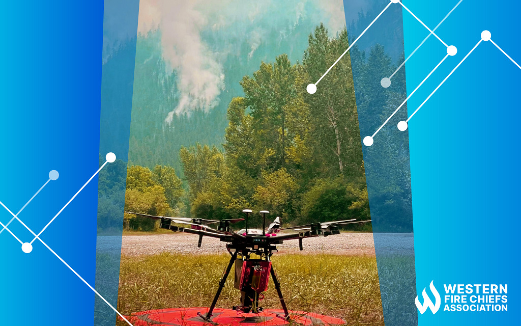
While firefighters sometimes use aircraft to fight wildfires, this tactic is inherently dangerous. Aerial firefighting carries risks of pilot error, mid-air collisions, and crashes. Flights are limited by poor visibility and turbulence from the wildfire’s radiant heat. States are beginning to use drones instead of firefighting planes. These unmanned aerial systems can be piloted remotely, with AI, or with pre-programmed flight software. 2 Firefighting drones can have high definition, infrared, and thermal imaging cameras to spot dangers on the ground, pinpoint resources, and generate terrain maps to help firefighters navigate the area. 7 Drones can also set prescribed burns to slow or redirect the path of a wildfire. 2
Additional risks of aerial firefighting include:
Drones offer a number of advantages over manned aircraft for aerial firefighting. Drones are smaller and more maneuverable than manned aircraft, which makes them better suited for flying in the challenging conditions of a wildfire. They are also less expensive to operate than manned aircraft, and they do not put pilots at risk.
Most drones are not large enough to materially contribute to fire suppression efforts because of limitations in their payload (retardant is heavy) and range. Currently, these smaller, slower drones cannot easily co-exist in the Temporary Flight Restrictions around a fire because they pose great danger to larger, heavier lead planes and tankers in the airspace, and airspace deconfliction typically does not include consideration for drones around wildfires. Increasingly, advancements in autonomous technology have begun to show up in the form of retrofitting helicopters and airplanes with control systems that allow for remotely-piloted missions; essentially controlling the heavier aircraft remotely, and removing pilots from the dangerous areas. This strategy is similar to the way the military equips helicopters and fighter aircraft with remotely-piloted control systems.
As drone technology continues to improve, drones are likely to play an increasingly important role in aerial firefighting. Drones can be used to spot fires, assess their size and severity, and drop fire retardant or water on the flames. They can also be used to map the fire’s progress and to help firefighters navigate the area.
Robots can directly fight fires in ways that would put human lives at risk. They can have heat-sensing cameras or on-board fire suppressants and water, and can carry heavy equipment or help evacuate people without risking firefighter safety.8 They can be designed to navigate steep terrain or enter burning homes. Most current firefighting robots are controlled remotely by firefighters, but there is potential with AI to enable robots to make decisions about firefighting strategies on their own.9
The growing interest in devices connected to the Internet of Things (IoT) is based around objects that connect on closed private internet networks and share data with each other. Automated systems gather information from these objects, analyze it, and either help perform a particular task or learn from a process.10
Organizations are developing IoT systems to give early warning of wildfire activity in remote areas. With a long-range, low-powered, wide-area network of sensors, these devices are always on standby to pass fire detection information to each other. The data moves between each device until it reaches a base station that is connected to the Internet and able to deliver the warning to emergency services, ideally within minutes of detecting the fire. The IoT-networked sensors can cover thousands of square kilometers and are designed to need minimal service.11
Ground- or forest-based sensors may be destroyed by fire, but IoT systems can also network infrared sensors mounted to autonomous drones. These IoT-connected drones can deliver early warnings of the burn time and temperature of a growing fire.4

Stay safe around the campfire with tips from the Western Fire Chiefs Association. Learn essential precautions and practices for a worry-free outdoor campfire.
Discover essential firework safety tips to ensure a dazzling display without accidents. Learn how to celebrate responsibly with expert guidance from WFCA.
Explore the role of AI in wildfire prediction with guidance from the WFCA. Learn how advanced algorithms and data analytics enhance early detection and response.