Fire Pit Safety Tips
Stay safe around the campfire with tips from the Western Fire Chiefs Association. Learn essential precautions and practices for a worry-free outdoor campfire.
Learn how debris flows caused by wildfires can have a devastating impact on communities, and what can be done to mitigate the risks with expert guidance from the WFCA.
Published:March 27, 2023
Edited:March 1, 2024

Learn how debris flows caused by wildfires can have a devastating impact on communities, and what can be done to mitigate the risks with expert guidance from the WFCA.
The immediate impact of a wildfire is clear: smoky air, burned forests, and possibly property damage. There are also long-term effects on the area impacted by fire, including a higher risk of flash flooding and landslides. Communities throughout the western United States are developing strategies to mitigate destructive debris flows in areas that have been affected by a fire. Consider risk in your area and learn the best way to respond to flash floods and mudslides that may occur after a wildfire.
Wildfires burn away low vegetation and trees, clearing large swathes of land. This leads to an increased risk of flooding, landslides, and mudflows in areas affected by a fire. The resulting shift of soil, rocks, mud, and water, which is usually triggered by intense rainfall, is called a post-fire debris flow.1
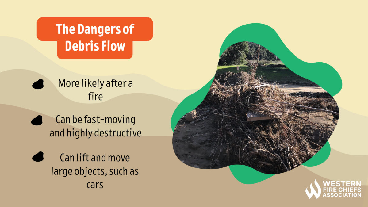
Debris flows are fast-moving and can cause human fatalities in addition to damaging property. They can travel greater distances than landslides, move faster, and carry anything in their path, from boulders to cars.
When soil is exposed, it is vulnerable to erosion. In addition to clearing large areas, wildfires can destroy root systems that were holding dirt and rocks in place. After a fire, communities, buildings, and roads that are in or near canyons, at the base of steep hillsides, or excavated hills are at serious risk for post-fire debris flows.2
The aftermath of burned vegetation and forest floor debris can also produce water-repellent soils, known as hydrophobic soil conditions. These water-repellant soils cause intense runoff, more than doubling the rate at that water will flow into streams or water channels.3 This creates a flash flood risk, and a risk of landslides and mudslides.
The U.S. Geological Survey (USGS) assesses post-fire debris flow hazard conditions after major fires in the Western United States. They have an online map that notes post-fire debris flow risk locations. After a fire, national, state, or local teams take the following steps to address debris flow hazards:
The USGS uses geospatial data related to historical debris flows in specific basins to assess the likelihood and severity of a post-burn debris flow in that area. This estimate considers the shape of the land, severity of the fire, soil properties, and rainfall characteristics.4
Local geologists and hydrologists may also assist communities impacted by wildfires. They utilize aerial imagery and satellite data, geological surveys, hydrologic and debris flow models, and in-person observations to assess site-specific conditions. They consider local geology, soils, climate, and topography to develop a debris flow hazard assessment and mitigation plan.3
While it is impossible to stop a debris flow, there are tools to give advanced warning of a flood or landslide. Automated cameras may be installed to monitor post-wildfire flooding and debris flows in specific areas.1
Emergency response teams may address risks that can be mitigated within 3 months of a fire, such as developing action plans, gathering resources like sandbags, notifying community members of emergency measures, and clearing drainage areas.5
Post-fire flash flooding and debris flow risks remain for several years after the fire. An example of appropriate caution is the response to the Eagle Creek Fire, which consumed nearly 49,000 acres in Oregon’s Columbia River Gorge between Sept. 2 – Nov. 30, 2017.
The Columbia River Gorge is made up of steep cliffs, forested areas, hydroelectric dams, and major transportation lines. It receives over 100 inches of precipitation annually and was already at risk of landslides, with over 80 landslides recorded in the 20th century. After the Eagle Creek Fire, the Oregon Department of Transportation, the Oregon Department of Geology and Mineral Industries, and the USGS participated in the creation of a post-fire landslide response plan and hazard map to address potential post-fire debris flow and flood emergencies.6 While no major landslides have occurred as of early 2023, some portions of the Columbia River Gorge National Scenic Area remain closed for parts of the year.7
Some of the largest landslides can happen during the first rainy season after a fire. Preparing for potential debris flows is important because they can occur with little warning, and flash floods and landslides may continue for several years in a burned area. It takes much less rainfall to trigger a debris flow in an area that has been burned—some debris flows have begun after as little as 0.3 inches of rain in half an hour.1
The Milli Fire took place in Deschutes County, OR, and burned over 24,000 acres between Aug. 11 – Sept. 24, 2017. Almost a year later, on June 20, 2019, a debris flow began on the edge of the burned Black Crater volcano. No property was damaged and there were no casualties, but the flow sped down the sharp incline near the crater rim for 1.5km.8

While post-fire debris flows are documented throughout the western United States, Southern California is particularly at risk.1 The number and intensity of wildfires are rising in California, and the state’s mountainous terrain is ideal for debris flows. There is also a growing wildland-urban interface as humans continue to expand cities and suburbs. This leads to a growing risk to human life and property from wildfires and post-fire debris flows. A 2021 study funded by the USGS Landslide Hazard Program projects that postfire debris flows will occur annually in southern California, with the risk to property rising as rainfall intensity increases.9
One recent example of post-fire debris flow devastation is the aftermath of the Thomas Fire. The fire began on December 4, 2017, and burned nearly 282,000 acres in Ventura and Santa Barbara Counties before it was contained on January 12, 2018.10 On Jan. 9, 2018, the nearby town of Montecito, CA, was hit with massive mudslides in the early morning hours. The post-fire debris flow came from the still-smoldering Santa Ynez Mountains. A short downpour had overflowed uphill creeks and basins. A flow of mud up to 15 feet deep moved boulders the size of houses down the slope. It swept over 3km of residential properties. A total of 23 people died in this destructive debris flow, with at least 167 injured and 408 properties damaged.11
The south coast of California is prone to debris flows, with most of the major events in the past 200 years (some described as tidal waves of boulders, trees, and water) occurring five years after a wildfire took place in the mountains. There are various mitigation projects underway in the Transverse Mountain Ranges of Southern California, including expanding overflow basins near creeks for rainfall drainage and to capture debris, and installing nets to catch debris above existing basins.12
As wildfires are growing in frequency and intensity across the western USA, this region is also increasingly at risk of runoff-initiated debris flows. Take precautions to keep yourself and your loved ones safe from this type of disaster.
Stay safe around the campfire with tips from the Western Fire Chiefs Association. Learn essential precautions and practices for a worry-free outdoor campfire.
Discover essential firework safety tips to ensure a dazzling display without accidents. Learn how to celebrate responsibly with expert guidance from WFCA.
Explore the role of AI in wildfire prediction with guidance from the WFCA. Learn how advanced algorithms and data analytics enhance early detection and response.